

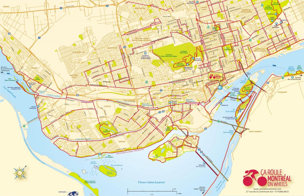
You can find on this page the Montreal bike map to print and to download in PDF. The Montreal bicycle map presents the bike routes and lanes of Montreal in Quebec - Canada.
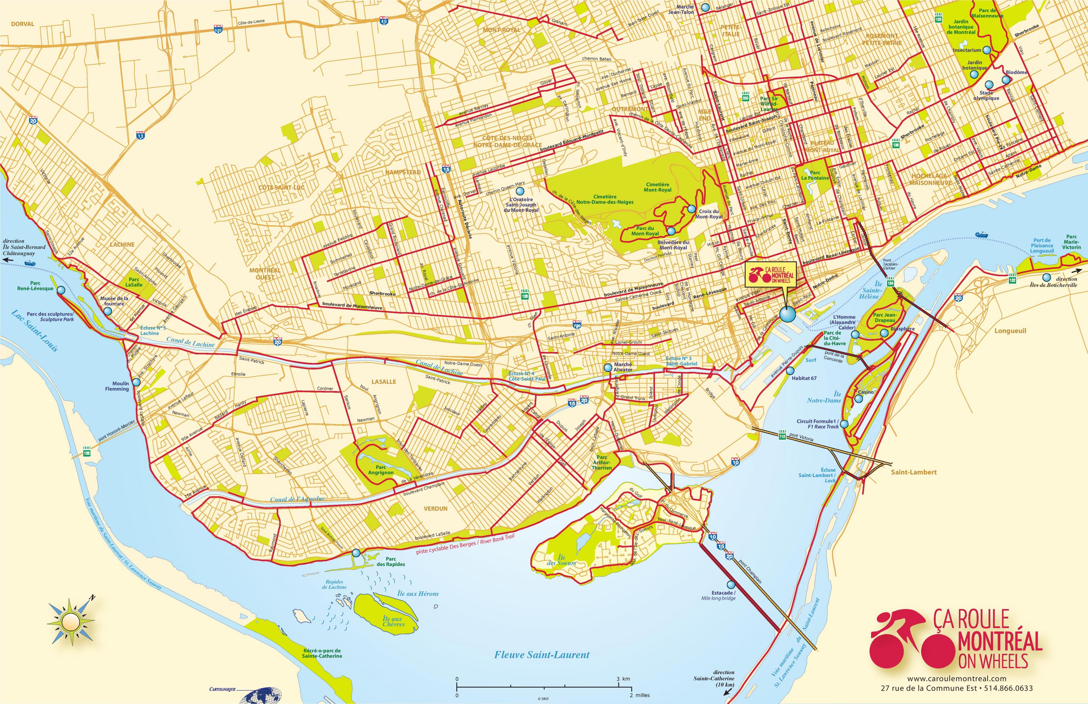
The Montreal bike lane map shows all the bike routes of Montreal. This bicycles lanes map of Montreal will allow you to easily plan your routes with a bike in Montreal in Quebec - Canada. The Montreal bike lanes map is downloadable in PDF, printable and free.
The City of Montreal began a city-wide rollout of rental bicycles in May 2009, in an effort to encourage locals and tourists to make use of the city already well-established network of bike paths as you can see in Montreal bike lane map. The rental bicycles are available from depots located throughout the city, where bikes can be rented from automated stations using a credit card. BIXI (a combination of BIcycle and taXI) estimates that by 2009, 2,400 bicycles will be deployed at 300 depots throughout the metro area. Time Magazine named the bike rental system #19 in Time Top 50 Inventions of 2008. Bike rentals are also available at the Old Port of Montreal, as well as quadricycles, inline skates, children trailers, and segways. The system was created to offer an attractive and easy-to-use option that complements existing public transportation networks for those seeking an urban alternative to traditional fuel-powered vehicles.
In 2019, Montreal was ranked the best North American city for cyclists (and 18th worldwide) by the Copenhagenize Index. It is the only city in North America to rank in the top 20 every year since 2011. The city is crisscrossed with a wide variety of routes, running from one neighbourhood to another. They go through parks, along the waterfront, etc. In Montreal, there are bike routes for everyone. Various BIXI stations are located along these routes, so you can rent and return your bike whenever you want. The latest addition to Montreal bike routes is the Express Bike Network (also known as the REV or Réseau Express Vélo in French) as its shown in Montreal bike lane map. This 184 km project, which will have 17 routes accessible 12 months a year, is already allowing BIXISTS to travel safely and efficiently. In the long run, the REV will reduce greenhouse gas emissions and noise pollution while improving access to local points of interest and businesses.
Montreal is a biking city with a vast network of paths that can take you all over the city, through parks and along the river. Lachine Rapids: The north shore of the St. Lawrence River from René Lévesque Park in Lachine to Arthur Thérrien Park in Verdun as its mentioned in Montreal bike lane map. The 12-kilometre path gets top billing because of the great views of the rapids, the frequent bird viewing opportunities, services every two kilometres or so and the wealth of things to see and do along the path. Families can start at either end or anywhere in the middle and enjoy themselves no matter how much of the route they complete. Lachine Canal: Between Lake St. Louis Park and the Atwater Market. There is not quite as much to do along this nine-kilometre path (unless you stop to rent a kayak), but the many options at either end make the trip well worthwhile. The bike path itself crosses no streets and follows a parkland route well away from roads.